


Following the Finke River


Jun 04
#6: Stuart Highway Crossing - Ampire Waterhole
Publiziert am 12:19
3rd and 4th June
Total Distance - 251km
Day 6
While near to the main highway, the plan was for Bob and Brian to drive
up to Stuart’s Well (approximately 80km from Alice Springs) to top up
fuel and water and whatever food supplies were available. They would
then use remote station tracks and even a fence line track to drive to
meet me at Harts Well on the river, about 25km via the river from the
Stuart Highway crossing.
I was slightly apprehensive, after what happened on Day 1, as Bob helped
me lift the bike over the barbed wire fence and I set off on my own.
750m later there was another barbed wire fence, but this time I lifted
the bike over myself. Being a well-stocked station, the whole riverbed
was almost continuously broken up by hoofs making progress very tedious
and slow. I tried the banks, through the trees and the riverbed. After
about 6km, the river splayed out and I thought I was following a
tributary. Usually I can determine the direction of the flowing water by
the debris gathered at the base of the trees and other obstacles, but
there was no evidence at this point. I thought I was going in the right
direction and followed the channel for maybe 1500m. Once I passed a
small waterhole, I started to see debris hooked on the vegetation and
worked out I was travelling in the wrong direction. I followed the creek
line in the direction of flow as indicated by the debris and ended up
back at the beautiful Snake Waterhole on the Finke. From there I won’t
make the same mistake.
We had a communications plan that entailed Brian checking in with me on
my satellite phone every hour while we were apart. I would have to stop
and fire up my satellite phone to receive Brian’s BGAN message. They
were also able to see where I was on the SPOT tracking map on my
website, and I would also press ‘check in’ on that device to show
exactly where I was.
It was a serious effort to get across Henbury Station country due to the
number of cattle and frequent waterholes. It is a beautiful station
though. No need for fences because to muster the cattle they would just
have to concentrate along the river environs and it’s strings of
waterholes.
We met up successfully at Harts Waterhole at around 2.30pm. Then just
after we set off together, Bob got bogged. He waved me on saying they
would be OK and I continued mixing it up, following animal tracks along
the banks, struggling over sand and sometimes going through firmer
ground just back from the bank.
After covering 5km, I started to wonder where they were. Then after 9km
and still no sign of them, I stopped (4.45pm). About half an hour later,
Brian checked in on the CB radio, meaning they were no more than 5km
away. Then, as they approached on the middle island I tried to use the
CB radio to guide them in and the battery cut out. They drove straight
passed and I couldn’t get their attention. It was quite some time before
I could hear the engine again. The SPOT tracker gave an accurate
location and all was fine. We camped on the island adjacent to where I
was waiting. I now carry spare batteries on the bike! 36km done.
Day 7
Bob estimated it was about -3C in the early hours of the morning - there
was an inch of ice covering the large water container and Brian’s tent
had frost on it. Today we passed several waterholes; Redbank (where we
were aiming to get to last night), Horse Camp, 15 Mile, Little Ampire
and Ampire Waterhole.
After Horse Camp we took a short cut overland, though technically
still within the Finke floodplain. By the time we arrived to the
riverbed, my 4.8 inch wide tyres had become a pincushion for more than
a hundred doubles gees (or cat’s heads, centurions, three cornered
jacks, devil’s eggs - depending on which state you come from). Bob
and I slowly brushed them off and where the spikes had pierced the
tyre, sealant spurted out and immediately closed the hole. Amazingly
the tyres were fine.
Next obstacle was a fence. I was easily able to get under it in the
river, but Bob had to undo the wire ties, stretch the barbed wire to the
ground and put something over the wire to protect his tyres. It was then
a case of driving over the fence and replacing the ties. He takes pride in leaving the fence in a better condition than it was previously.
In the mean time, I continued, mostly on and off the banks. At one stage
though, I hit a root in an animal track while also avoiding a low branch
and came off, injuring my left forearm. It was just another graze to add
to my collection, but a bit of a wake up call.
My favourite waterhole of the day was 15 Mile, with a beautiful ochre
cliff as a backdrop and plenty of small birds. My favourite part of
today’s ride was the approach to Little Ampire Waterhole. The river was
one wide strip on pure sand, virtually undisturbed by cattle, brumbies
and donkeys. It was these kind of surfaces that I had hoped to have more
of when I planned this journey. I could move along quite nicely, without
much of a struggle at all.
Bob and Brian went on ahead after lunch and set up camp at Ampire
Waterhole, hung out the washing (that had been sitting in a
container being washed as the vehicle bumped along), and Brian set
up another interview for the documentary, that I did as soon as I
arrived after 37km.One week done and we are about half way to the community of Finke.
Look up the SPOT tracking map here:
http://www.breakingthecycle.education/expeditions/following-the-finke-river/
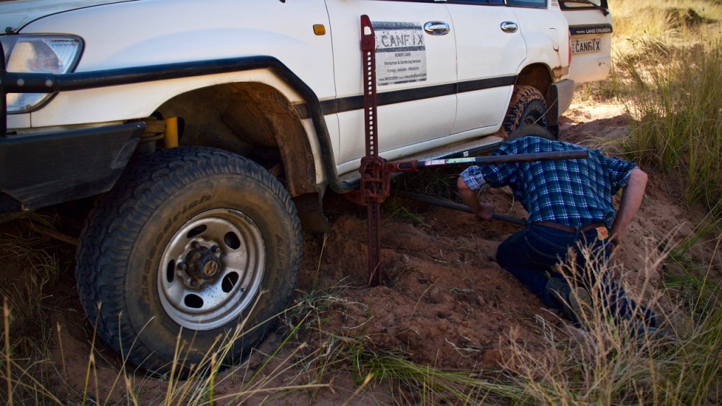
Bog no.5
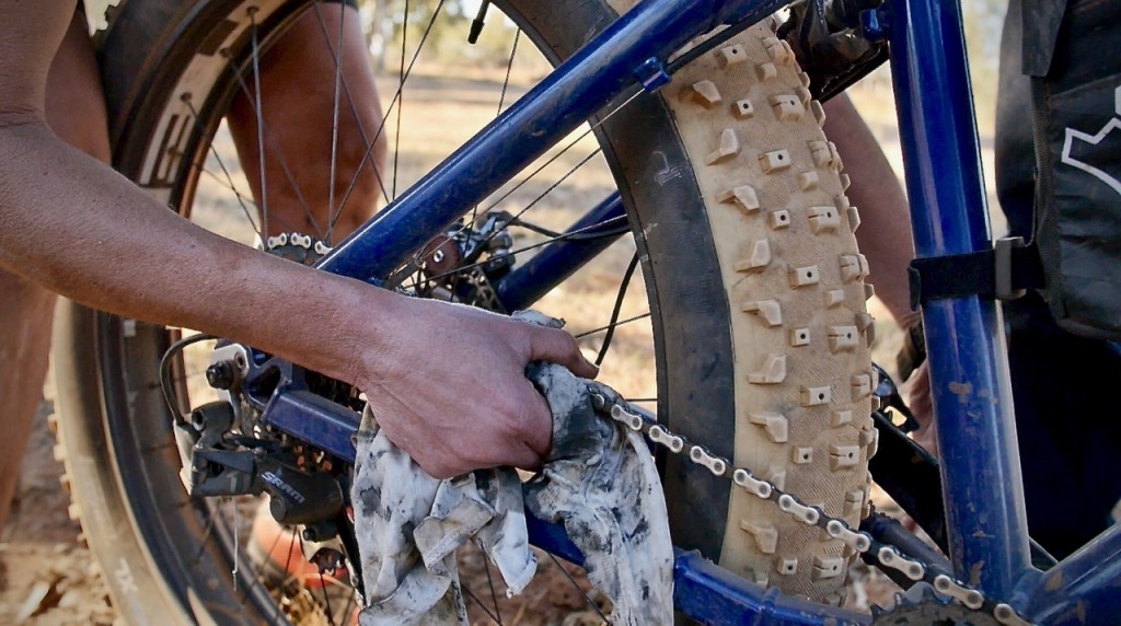
Adding dry lube to my chain at lunch

Bob helps me with my bike over the first barbed wire fence on Henbury Station
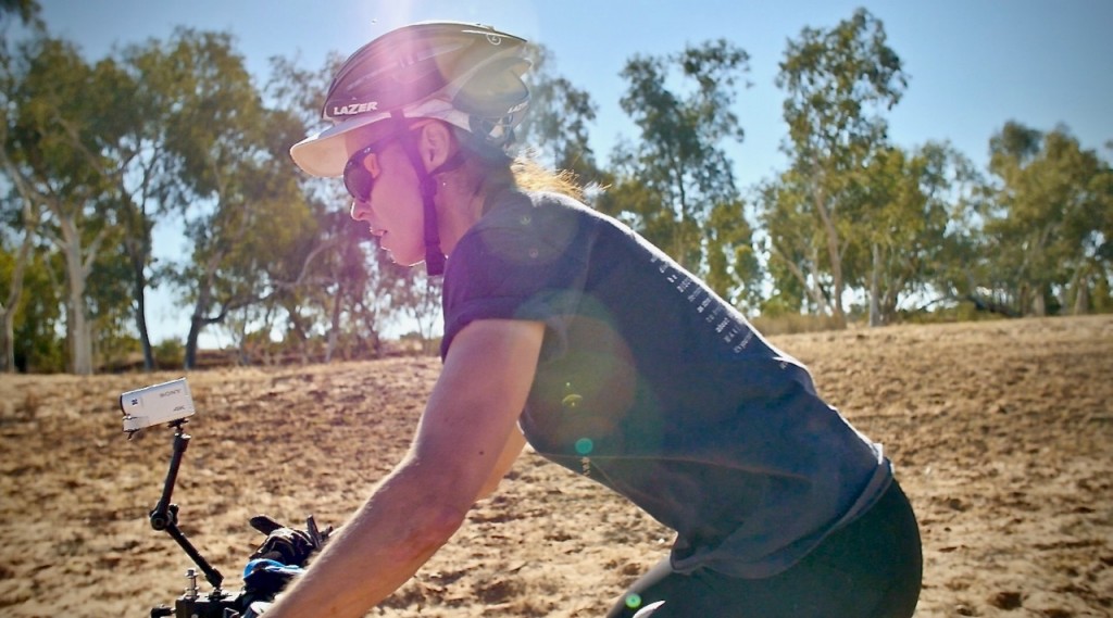
Setting off from lunch, Harts Waterhole
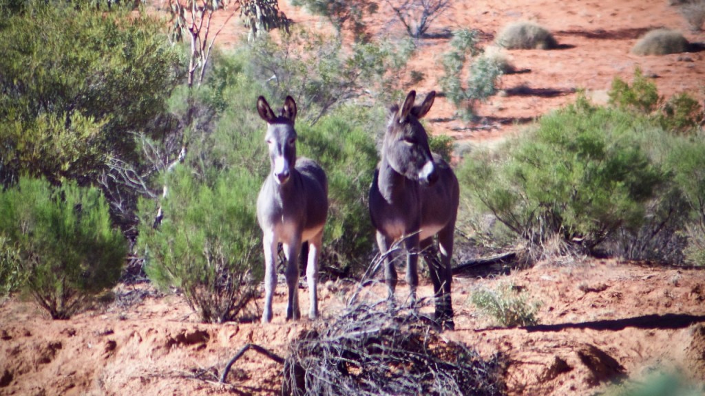
Donkeys
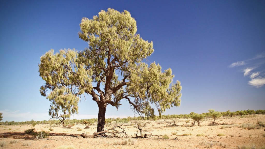
Extremely old desert oak, possibly 800 years to be this size
Add Comment


Comments