Breaking the Cycle Yukon
Mar 22
#8: Challenging days and Northern Lights
Published at 08:55
After a couple of brilliant and successful days riding from Fort
McPherson, up Stoney Creek to it's headwaters, I hit some tough times.
The usual trail would have continued up the creek, then follow another
waterway before a difficult mountain pass. The path was diverted because
the creek has overflows, meaning that water flows over the ice and makes
the trail dangerous to follow. The alternative was a steep climb out of
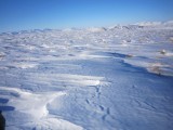
the valley and on to a hilly, treeless undulating expanse. The main
issue was that the ground was covered with dense tufty grasses, covered
with sugary snow. There was rarely a solid surface because in between
the spongey grass it was very soft. Snow mobiles can still make it over
these surfaces, even if it is an uncomfortable ride, however for me it
was generally unrideable.
We met a small group of dog mushers travelling in the opposite direction
and were told that these high plains covered in the tufty grasses went
for about 10km or so. I started pushing, my feet regularly sinking deep
into the snow. My cycling boots are not made for walking; the soles are
extremely hard, which is good for cycling but to walk I may as well have
been walking on planks of wood. Every time the surface looked like I
might have a chance of cycling, I'd give it a try, but mostly it was
very short-lived, very taxing energy-wise, and I would more often than
not end up falling. Still, I was prepared to push through it thinking
that would be just a few uncomfortable hours. Claudio would go ahead and
wait for me to catch up. He managed to get some amazing footage with his
drone, showing the contrast between me struggling through a harsh but
beautiful landscape.
It was getting late and we finally could see the decent (after 14km) to
the next stream, however we were met by Bob and Theresa who had gone
ahead to investigate. That creek to was blocked too with overflows and
they had both come off their machines. The alternative was much more of
this kind of terrain followed by the mountain pass. I was prepared to
keep going, but at the speed I was travelling, we would have spent too
much time just trying to get to Old Crow, and as there are no roads in
and out of the village, we would have only had time to turn around and
retrace our route, rather than heading up to the Beaufort Sea, as
planned, with potentially much more of this surface on the route north.
There is also no wood in these parts which we need to stay warm at night
in the 'Arctic Oven' tents.
I had my heart set on cycling to Old Crow, so I was very reluctant to
change plans. Decision making was even more difficult for me because I
had been slogging it out all day, was tired and starting to get very
cold standing while deliberating on the high ground. In the end, I know
we've made the right decision to adapt out plans.
We returned to the cabin near to our campsite from the previous night,
then today we've retraced our route back to Fort McPherson. We now plan
to head north to Aklavik tomorrow on an ice road that largely runs along
the Peel River. We will check with the locals, but we will aim to head
to the Beaufort Sea, Shingle Point and if going well to Herschel Island.
This is the northern section of the route I had planned with Bob. We may
also then have time to travel back to Aklavik, and follow the ice road
to Tuk (Tuktoyaktuk) at the head of the Mackenzie River Delta. This was
also in my original plan if we had time. This year will be the last time
this famous ice road, built in the winter months over the Mackenzie
River Delta, will be in operation. Next year it will be replaced by a
proper road. The 3000-strong reindeer herd will cross the road at about
the time we will be on the ice road, so that should be a great
spectacle.
Last night Claudio managed to capture a spectacular display of the
Aurora Bolealis from our cabin. Here's a link to his first video for
this expedition:
www.vimeo.com/claudiovonplanta/northernlights
Northern Lights from Claudio von Planta on Vimeo.
- Name: .....
- Elevation: 43 m
- Latitude: 67° 26’ 11” North
- Longitude: 134° 52’ 51” West


Comments